POOL 5 - WEEK 6: GIS
BLUE DRAGON TRAINING POOL 5 - WEEK 6: GIS
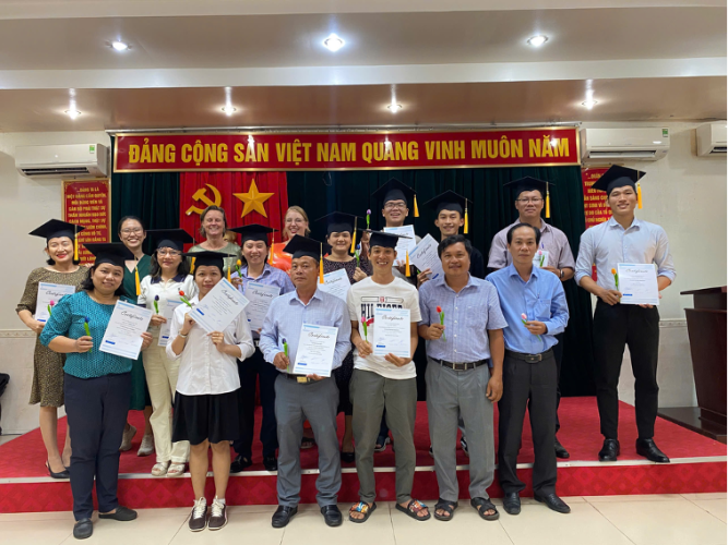
The three-day Blue Dragon training program for Pool 5, Week 6, focusing on the Application of Remote Sensing (GIS) in Agriculture and Water Resources research and management, successfully took place from November 17 to 19, 2025, at the Department of Agriculture and Environment of Cần Thơ city. The course brought together a team of highly experienced and reputable experts: on the Vietnamese side, lecturers from Cần Thơ University, such as Mr. Trương Chí Quang and Ms. Phan Kiều Diễm; and internationally, two experts from the Netherlands Water Partnership, Wietse Wierks and Rob van Ede. Notably, the course attracted the enthusiastic participation of nearly 40 officials who apply GIS in their professional work, coming from various agencies and units in provinces across the Mekong Delta, including Cà Mau, An Giang, Cần Thơ, Vĩnh Long, and Đồng Tháp. This highlights the great interest and significant need for cultivating and improving skills related to Remote Sensing technology.
Day 1: Remote Sensing Foundation – MODIS Imagery Acquisition and NDVI Calculation
The first day of the training workshop focused on getting acquainted with MODIS Remote Sensing Imagery (a type of satellite image) and the method for calculating the Normalized Difference Vegetation Index (NDVI). Trainees were guided in detail by Mr. Trương Chí Quang (Cần Thơ University) along with international experts Wietse Wierks and Rob van Ede on how to download these satellite images and perform initial processing steps. The most crucial point was the methodology for calculating the NDVI – a value that indicates the level of greenness and health of vegetation. The experts instructed the trainees on how to generate a time-series of NDVI (e.g., monthly), enabling them to monitor crop development throughout the year, thereby facilitating the identification of different crop types.
.png)
.png)
Photo: Trainees practicing working with MODIS Remote Sensing Imagery and the NDVI index.
(Source: Blue Dragon Program Vietnam)
Day 2: Data Analysis and Classification of Agricultural Land Cover
Following the success of the first day, the second training day shifted to the in-depth content of Principal Component Analysis (PCA) and Remote Sensing Image Classification.
Under the guidance of Ms. Phan Kiều Diễm (Cần Thơ University), trainees learned about the nature and purpose of PCA – a powerful tool for reducing data dimensionality from the up to 12-month NDVI image time-series. The practical session focused on applying the Random Forest algorithm to classify agricultural land use/land cover, utilizing the Semi-Automatic Classification Plugin (SCP) in QGIS. Ms. Diễm provided detailed instructions on the process of selecting Training Samples (Region of Interest - ROI) on the map and Accuracy Assessment, helping trainees master this efficient classification tool for analyzing different crop types and land status.
.png)
.png)
Photo: Ms. Phan Kiều Diễm guiding trainees on using tools for analyzing crop maps and land status.
(Source: Blue Dragon Program Vietnam)
Day 3: Automating the Analysis Workflow and Practical Applications
The final day was an intensive practical session, focusing on applying all the learned knowledge to real-world scenarios. The two international experts, Wietse Wierks and Rob van Ede, introduced a powerful tool in QGIS (free mapping software) called the Graphical Modeler. This tool allows users to automate all complex analysis steps, from image download, index calculation, to classification, with just a single model run. This significantly saves time and ensures consistent results.
The experts worked with the trainees on an engaging case study in the Netherlands: using the automated model to find the most optimal location for building a wastewater treatment plant. This exercise not only helped trainees review the three days of knowledge but also clearly demonstrated the applicability of Remote Sensing technology in planning and resource management
.png)
Photo: The practical modeling exercise received positive feedback from trainees.
(Source: Blue Dragon Program Vietnam)
ACKNOWLEDGMENT AND EXPECTATIONS
The three-day specialized Remote Sensing training workshop has concluded with great success. The Blue Dragon Program wishes to express its deepest gratitude to the Department of Agriculture and Environment of Cần Thơ city and the Mekong Delta Regional Coordination Office.
Thanks to the close coordination and enthusiastic support from these units regarding administrative procedures and facilities, the training program proceeded smoothly and achieved all its intended objectives.
This success is a tremendous motivation. We hope that in the upcoming training weeks, the relevant parties will continue to maintain effective cooperation, and that the esteemed trainees will continue their active participation to fully absorb the knowledge on Remote Sensing technology, thereby effectively serving their local management work.
Related post
BLUE DRAGON PROGRAM MANAGEMENT MISSION ON MARCH 2026
BLUE DRAGON PROGRAM MANAGEMENT MISSION ON MARCH 2026